As mentioned in the early history, Domestic Textiles were dominant in the area by 1848, especially handloom weaving, often supported by Putters Out or Chapmen. In the Lammack area, Seven Acre Brook was an important handloom weaving centre. Other known places of interest were Higher Waves Farm which was a farmhouse with barn attached, Stoops Fold where handloom weaving was recorded by census which had adjoining farm cottages, Lammack Slack where there was a barn and farm cottages but no farmhouse. Along the Whinney Lane track was Rough Hey a large building converted into two dwellings which had a hand weaving loom shop, and, further on, Bullion Moss, a farmhouse just off the map, and Hawkshaw Bank at the top end of the Lammack Track. All these sites were involved in farming but supplemented incomes especially in the winter months by handloom weaving, although, over time, many farm labourers became full time weavers as they could achieve much higher wages. Later in the century, farm machinery inventions led to less labour being required. It is known that, in 1837, John and Martha Sefton lived at Lammack Slack, probably in a leased cottage and he worked as a farm labourer in summer and a weaver in winter. However, his wife left him and took their five children and moved to nearby Cunningham House, which, in the early 19th century, was occupied by handloom weavers and John left to settle at Lower Wilworth in Pleckgate where there was another handloom weaving cottages.
In 1848, settlement in the area was sparse with seven Acre Brook and Revidge Fold at the entrance/exit of the area having the only sizeable clusters of buildings. It is significant that Seven Acre Brook as its name signifies had a stream passing it, as did Lammack, where the track passed over a stream by a small bridge. In these earlier times, water supply, especially in rural areas, did not exist for dwellings, therefore, being sited near to a constant water supply was important. Also visible in the area are a number of wells which would also provide a water supply to farms and farm animals. Cunningham House, a large building alongside Lammack track, could possibly be linked to James Jenny Cunningham who lived from 1796 to 1876 and was a self-made man. He arrived in Blackburn in 1838 from Scotland as a butler for a wealthy landowner and later cotton magnate, namely, William Feilden of Feniscowles Hall, and later used his savings to buy a small brewery at Snig Brook alongside the later built Montague Street in Blackburn. James built a large house next to the brewery which later became St. Pauls Working Men’s Club. He became town mayor and could possibly have built Cunningham House as a retreat. By1807, Thomas Dutton realised the potential of opening tied public houses/inns with his first purchase being the Golden Ball on Blakey Moor where Blackburn Sessions House now stands and close to the original cattle and horse market site at Blakey Moor. His second purchase in the early 1800’s was the Hare and Hounds Inn at Lammack which still exists.
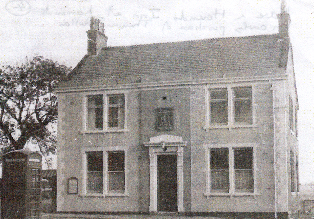
Hare and Hounds Inn at Lammack an early purchase of Thomas Dutton.
It is also known that there were some early Beer Houses in the Pleckgate area to supply the local handloom weavers together with an early inn built at Four Lane Ends close to the entrance to the Lammack Track called the Jolly Dragoon Inn (see 1848 map).
The Jolly Dragoon
The site of the Jolly Dragoon Inn at Four Lane Ends, Revidge Fold which was a low stone built inn well placed to supply the locals and later changed into two cottages. Revidge Road was originally an open country track called Pippen Street.
Four Lane Ends
This picture shows Four Land Ends today with the top of Lammack Road centre, Revidge Road to the left and Pleckgate Road to the right bordered with old stone cottages built before 1848 and still in existence with some alterations.
In 1814, a Joseph Ainsworth died; it was recorded that he owned two cottages at Four Lane Ends and three dwellings at Stoops Fold in the Lammack area (see map).
ORDNANCE SURVEY MAP OF THE PLECKGATE AREA IN 1848
The map shows this area was slightly larger than Lammack but similarly had a main trackway (later Pleckgate Road) running through it; starting from Four Lane Ends (Revidge Fold), down to Brownhill and Whalley New Road. However, this track had far more minor tracks running into it coming from various farms and the quarry and footpaths leading across to the Roe Lee area crossing the newly built railway from Blackburn to Whalley/Clitheroe areas. As in the Lammack area, the settlement at this time is small and scattered but there is a greater number of buildings than Lammack with the main groups of settlement close to the main track including Pleckgate, Toddy, Aspinall Fold, the Royshaw area and Four lane Ends. The buildings at this time consisted of stone cottages and farmhouses with the main cluster of buildings at Pleckgate where the track crosses the stream, a fact repeated at Aspinall Fold and Upper and Lower Royshaw, due to the importance of being close to a good water supply. There was an absence of a direct water supply to homes although there were numerous wells in the area, however, at the Pleckgate settlement, a pipe is indicated, so possibly, this meant some water was piped from the stream to a stand pipe in the area. The Pleckgate area at this time was predominantly farmland with a similar field pattern to Lammack with larger fields often on the ridge slopes where sheep would have been raised. Smaller fields around the Pleckgate settlement would probably have been utilised for fodder crops and some allocated for dairy cattle. As in Lammack, farmers and farm labourers formed a large handloom weaving community with many cottages along the main Pleckgate track being rented farm cottages built of local sandstone from Royshaw quarry.
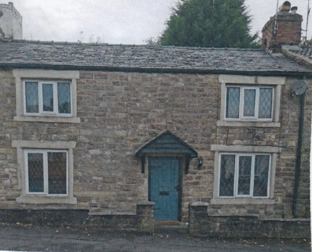 A typical early sandstone built cottage found alongside Pleckgate track (road)
By 1848, some cottage dwellers were totally operating as handloom weavers with converted back rooms or cellars to house the wooden looms and supplied with fibres from Blackburn based “Putters Out", many of whom were based in the King Street area. A good example of handloom weaver's cottages could be found in a group of cottages based round a courtyard at Lower Wilworth and on Pleckgate track itself at Pleckgate Fold, Toddy Fold, Aspinall Fold and Green Gowan.
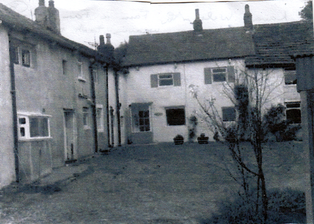
Lower Wilworth Farm
The above image shows Lower Wilworth Farm and its farm cottages as it is today based round a cobbled courtyard where handloom weaving occurred. The farmhouse is shown to the left with the stone cottages for labourers off to the right.
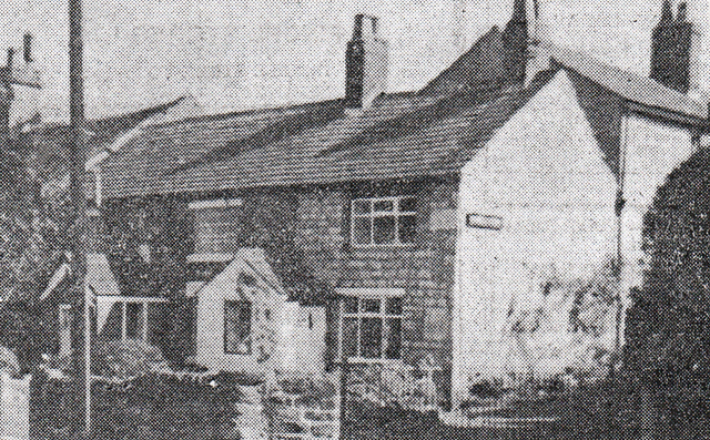
The stone cottage at Green Gowan on the Pleckgate track where handloom weaving took place
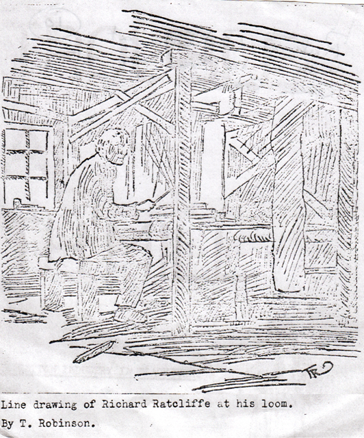
This line drawing is of RICHARD RATCLIFFE who was the last handloom weaver in the area
operating his loom at the cottage called Green Gowan
The main handloom weaving centres on Pleckgate Road itself were at Pleckgate Fold, Toddy Fold, Aspinall Fold and Green Gowan. However, it is known that in 1841-2 there was a widespread distress in both Lammack and Pleckgate areas where most cottages were involved in handloom weaving. Although generally employed, they received low incomes for their labour, and, when visited, they were found to be hard working, clean, managing and patient under great privations. Their main food was oatmeal porridge with either churned or sweet milk, stewed potatoes and onions but they rarely ate animal food of any sort. As a result, some inhabitants sold up and moved to nearby towns for work in the cotton mills. The 1845 rate book shows only two households out of nineteen paid rates at Aspinall Fold, no one, out of seventeen people paid rates at Pleckgate Fold out of thirty-seven, and, at Green Gowan, none of six families. At Four Lane Ends only seven families out of thirty-five paid rates. Therefore, all these handloom communities could rarely afford to pay the “Poor Rate”, some being excused by Magistrates whilst others had “no effects” on which to draw. The price of cotton pieces produced varied and increased lengths of woven material were required for the same price with soup kitchens opening in Blackburn for the poor people. However, although conditions at this time were not good, by 1848, textile spinning factories started to open in the Blackburn area which led initially for increased work for the domestic handloom weavers. By 1848, quarrying was still operating at Royshaw where sandstone was extracted for building purposes
Transport during this period relied upon horse and carts using the main Pleckgate, or minnow tracks, but many people had to walk, hence the number of footpaths visible on the map of 1848. The farmers would rely on the track system to take produce to Blackburn markets, or, to sell dairy produce locally. The recently completed railway from Blackburn to Whalley/Clitheroe would at this time have had little impact on the area; the nearest station was at Wilpshire.
An early inn found in the Lower Pleckgate area beyond Wilworth was a four roomed building made up of two cottages which had a chain on the outside wall for tethering horses. It had a tiny snug large enough to take eight drinkers on the bench seat that ran round a central table. Over time, this became the Knowles Arms which, at one time, had a bowling green behind it. This inn was also called 'The Folly' by locals but was officially called 'The Knowles' after a local landowning family.
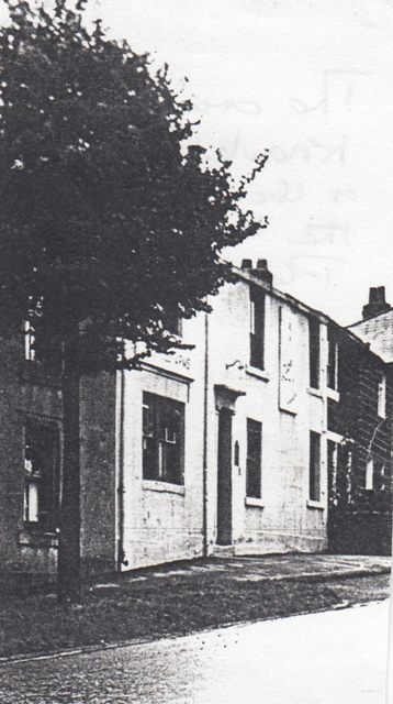 The original “Folly” or” Knowles” sited at the bottom of Pleckgate Road within a line of cottages
ORDNANCE SURVEY MAP OF THE LAMMACK AREA IN 1894
The map shows that in the 46 years, since 1848, there had been little change to the landscape. By now, the main Lammack track was a road although it was still not named Lammack Road. Taking account of the map scale there are few additional buildings shown except for the new settlement at Lower Willow Trees which was probably linked to the horticultural development where orchards or greenhouses were sited. This shows there was an increased demand for fruit, vegetables and shrubs for the larger houses with gardens. Lammack Slack depicts additional buildings and two detached large houses, or farmhouses, have appeared on the south side of the upper portion of Lammack Road, close to Four Lane Ends, one of which, appears next to Kalene Hill. At the same time, the former Lower House Farm properties have disappeared along with its track to the main road.
The area is still predominantly a rural one, dominated by farmland, but there are some changes to the field patterns with slightly less fields; some had been enlarged and a new area of woodland has grown. The Blackburn and Darwen Directory shows some details of people living in the Lammack area at this time namely:-
1. James Bradley – a farmer at Lammack Slack.
2. William Butterworth – a farmer at Lammack Slack.
3. Henry Richmond – a farmer and shop keeper at Four Lane Ends.
4. Thomas and William Pomfret – farmers at Hawkshaw Bank.
5. James Hayhurst – a retailer of beer at Four Lane Ends.
An 1871 census covering nearby Ramsgreave showed 20 heads of family who described themselves as farmers, mostly small tenanted farms. The Seven Acre Brook settlement was sited next to the Borough boundary and the Ramsgreave area but within the Lammack area. The only change to farming products by 1894 would have been the growth of poultry, pigs and dairy produce as diets had improved.
By now, after the distress caused to the domestic textile industry and early factory system by the American Civil War in the 1860’s which disrupted the supply of cotton to the industry and resulted in large numbers of locals having to claim relief from the Board of Guardians and having to pawn their furniture, the area had returned to calmer times. The farms by now would now have more mechanisation, although still horse drawn, following farm machinery inventions and therefore required less labour. Also, by now, domestic textiles, mainly handloom weaving, would have dwindled as the new factory spinning mills were well established and power looms introduced slowly to existing mills or new weaving sheds were built at some sites. As a result, the former farm labourers or handloom weavers would now travel to work in mills at the nearby Roe Lee, Carr and Florence textile mills along nearby Whalley New Road, or, travel down to those in the Brookhouse area.
By 1868, there was an independent school at Four Lane Ends to cater for local pupils sited close to the junction with Lammack Road alongside Revidge Road.
Picture of the former Primary School at Four Lane Ends
In 1871, Blackburn’s School Board was formed with two existing elementary schools under its management, one of which was Four Lane Ends which, by 1897, had become a Congregational Mission School; a chapel had been added to the school. However, by 1915, it had become a Borough Council school.
ORDNANCE SURVEY MAP OF THE PLECKGATE AREA IN 1894
As in the Lammack area this large-scale map shows clearly that the field sizes have in places changed with less fields because a number have been enlarged due to the development of new farm machinery. This led to the reduction of farm labourers even though the farm machinery was still pulled by horses. Farm buildings had also increased in size with outbuildings erected to house the machinery.
An early line drawing of Royshaw Farm in the area
Farms in the area were well placed to provide dairy produce, poultry and meat to the large new housing areas created off nearby Whalley New Road as these terraced streets were built to house many textile workers now working at the local textile mills such as Roe Lee and Florence mills.
A picture of the original Old Roe Lee Mill
The map shows part of the upper terraced streets sited above Roe Lee Old Mill including Pemberton Street named after the mills original owner who built the streets for the mills workers. As in Lammack, many former farm labourers and handloom weavers had moved to work in these new textile mills although some handloom weaving survived in small pockets. After the distress caused to textiles by the American Civil War there had been a growth in house building especially terraced streets close to the textile mills. Roe Lee Old Mill was built in 1856/7 by James Pemberton and Sons and contained 480 weaving looms, and, by 1861, employed 300 operatives increasing its looms by 1878 to 1008. James Pemberton originally worked a small shed in the King Street area and built Roe Lee Mill to increase the value of his estate which included land in Pleckgate and Wilworth areas but also to help unemployed handloom weavers in Lammack, Pleckgate and Ramsgreave. However, shortly after completing the mill he died, in 1887, with control passing to his sons. After two changes in ownership and latterly held by J.E. Sharples, it was then sold to Duckworth and Eddleston in 1902 with 815 looms. This and the nearby Carr Cottage mill they also owned together with the Skew Bridge Florence mill built by William Bertwistle in 1889 were all cotton weaving mills.
The 1894 map shows that the extensive quarries at Royshaw had greatly increased since 1848 as more sandstone had been removed to create local buildings and a larger quarry to the south had been created which operated a brick works using ground up sandstone to manufacture bricks which were now in great demand especially with the growth of terraced houses near the new textile mills and for some of the mills themselves.
Early education in the Pleckgate area was recorded in a newspaper (Blackburn Standard) article in 1863 when it was reported that the
Pleck Gate schools annual tea party held on New Year’s Day was attended by 230 people. It was addressed by the reverend J. Smith and the choir performed several pieces in very good voice with young men giving recitations. On the following day, 270 children were given tea with current bread after which Councillor H. Pemberton (son of James Pemberton of Roe Lee Mill) presented each pupil with an orange and a bun. The exact location of this early school was probably in the St. James Road area in the upper region of Pleckgate. The school site later became St James's Primary School after St James Church was built in 1874, and, in the same year money was raised for Church of England Schools and St James School gained an extension. However, it is known that building began in lower Pleckgate of a Pleckgate Mission Church in 1870 called St Chads Mission Church; this being a Mission attached to St John's Church on Victoria Street, Blackburn. This church was created to meet the needs of Pleckgate village and later developed into a thriving day school and Sunday school.
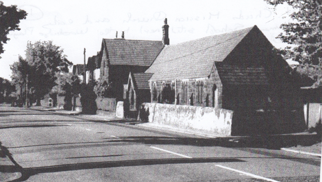
St. Chads Mission Church and early Primary
school sited next to the Woodridge Playing Fields
Internal view of St. Chads Church
1920 St. Chads Church football team which played in a local league 1920's.
This demonstrates how church activities extended into providing sports for their parish
Around the same time, Four Lane Ends Board School had been improved and the curriculum remodelled to more modern requirements with a greater emphasis on providing pupils with better sanitary conditions by 1894.
A new public house had now been built to serve the area at the top of Pleckgate Road where it met Four Lane Ends opposite the Jolly Dragon public house site. This was called the Sportsman’s Arms with its entrance on Four Lane Ends. The inn offered billiards and had a two stall stable to let.
The licensee JAMES THOMPSON KAY in the doorway of the Sportsman’s Arms
with his son and daughter in 1919
An 1870-71 Blackburn directory gives some indication of the occupations of local people living in the Pleckgate area at this time:-
1. Mary Briggs a shopkeeper living at Toddy Lane Ends.
2. Isaac Fawcett a farmer living at Higher Wilworth.
3. George Cook a farmer living at Lower Wilworth.
4. Richard Webster a farmer living at Wilworth
5. Mary Jane Hall a schoolmistress living at Pleckgate.
6. George Harwood a shopkeeper living at 37, Pemberton Street.
7. Henry Whewell a farmer living at White House Farm Pleckgate.
8. Thomas Gabott a beer retailer living at Pleckgate.
9. Richard Stones a quarry owner living at Back of the Hill.
10. Robert Bradley a master at St. John’s National School living at Pleckgate.

AN ORDNANCE SURVEY MAP OF THE LAMMACK AREA IN 1956
In the sixty-two years since 1894 there have been many changes in the Lammack area especially with the huge increase in housing and leisure activities. This upward trend was driven by increases in the general standard of living and the growth of the middle classes who migrated out of the central industrial areas of Blackburn to the greener and more rural sites, creating suburbs, where there were no new terraced houses. All the new growth of housing was in a linear pattern following the newly created Ramsgreave Drive/Yew Tree Drive orbital by-pass road and the upgraded Lammack Road/Whinney Lane links both of which were almost infilled. The new housing was mainly built between the two world wars with some new areas of growth created after the 2nd. World War; all privately owned and consisting mainly of semi-detached brick built properties often with a pebble dash finish and the odd detached house on the upper Lammack Road area with more recent semi-detached bungalows on Willow Trees Drive. Another new development was off Whinney Lane with the creation of Montreal Road which was the start of a much larger housing estate development. All the new housing had been created on former farm land with farming activities in the area reduced considerably, and, some farms, such as Willow Trees and Hawkshaw Bank disappeared. All the new housing was created with gardens front and back but varying in size as families demanded more space and gardening was popular. Garages were also added as car ownership grew.
On the transport side, the area is now dominated by the orbital by-pass road built to reduce traffic congestion in central Blackburn with links to both Lammack Road and Whinney/Barker lanes. Work started on building this orbital road in 1921 partially to relieve the heavy amount of unemployment in Blackburn after the Great War and was completed in 1927. All the work was completed by unemployed workers supplied by the local Labour Exchange. It was designed as a ring road around the northern edge of Blackburn running from Preston New Road through Brownhill to Whitebirk and the A678 Burnley to Blackburn road. Between Preston New Road and Whalley New Road at Brownhill the road was created 120 feet wide between fences and designed to eventually be upgraded into a dual carriageway each 30 feet wide with two footpaths, verges and central reservation. However, initially, it was one carriageway with the total length of the road being four and a half miles. The dual carriageway upgrade was completed in the early 1960’s.
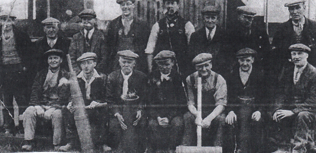
Blackburn Corporation workmen taking a break from building the orbital/arterial road
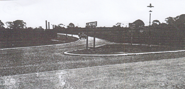
The junction formed by the orbital single carriageway and Preston New Road complete with sign to Wilpshire
Yew Tree Drive in the early days called Preston New Road! With the single carriageway and footpath
and fencing complete with an early 1920’s vehicle.
By 1956, Lammack Road had been upgraded and surfaced in tarmac as motor transport now dominated with many middle-class families now running their first cars.
A new and significant feature of the Lammack area by 1956 was the considerable amount of land, all former farmland, that had now been taken over for leisure pursuits by various organisations. This reflects the increasing demand from the new middle-class inhabitants for leisure activities as the working week had reduced thus allowing more free time and the fact schools now had to provide playing fields for their pupils as sports activities were deemed important. The earliest leisure development was in 1904 when Herbert Troop, a young brewer, started Blackburn Hockey Club on a field belonging to Lower Wilworth Farm behind the Hare and Hounds Inn where later the Old Blackburnian’s Football Club were based. The idea for a hockey club began during discussions Mr. Troop had with a group of young middle-class friends who played a little soccer but wanted to move to a more distinctive game. An early club captain was Alfred Livesey from a local firm of loom makers and a Miss Bailey who was the daughter of the Borough Treasurer. The Old Blackburnian’s’ Football club was formed in 1925 by old boys of Queen Elizabeth’s Grammar School, an off-shoot of the Old Blackburnian’s association which raised money for the grammar school. The football club that eventually became the “Old Blacks” originated from a meeting chaired by the school’s Headmaster – Arthur Holden at the Old Bull in Blackburn on the 7th. October 1919. However, a ground problem caused the club to close after two years but was the revived in 1925. It has grown over the last 97 years with the club having teams playing in the Lancs. Amateur League. Initially, it started with just one team playing in local fields including the one previously used by the Hockey club. The 1956 map shows a playing field behind Cunningham House probably belonging to Stoops Fold Farm which they probably used prior to the creation of the Memorial ground which was developed after the 2nd. World war for the 1st. team together with a secondary smaller pitch created in front of it close to the new club pavilion with changing rooms developed behind the Hare and Hounds Inn on land previously belonging to Lower Willow Trees Farm. The Old Blacks Football Club Chairman for 21 years, Ken Forbes, oversaw the opening of the Memorial Ground and new pavilion on Boxing Day, 1950, a day traditionally when there was a game against the school’s 1st X1.
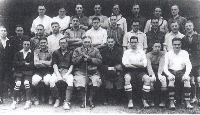
Old Blackburnian’s X1 in 1933
A picture of Old Blackburnian’s X1 in 1933 with their opponents W. T. Whewell's X1 (wearing white) at the Lammack ground on Boxing Day. On the front row, with a walking stick is the school headmaster, Arthur Holden, and, on his immediate left, Ken Forbes, the chairman of the Old Blackburnian’s Amateur Football Club. Prior to the development of the “Old Blacks”, Queen Elizabeth’s Grammar School acquired Harrison's playing fields at Lammack, in 1919, using £2000 bequeathed to them by the former chairman of the school’s governing body Alderman Henry Harrison. The playing fields officially opened on the 1st. July 1920 complete with a temporary pavilion in the form of a shelter hut! This now meant the school pupils had to track from West Park Road , up through Corporation Park to Revidge and over the tank and down past Cuckoo Hall to the new playing fields. As more pupils attended, the school the situation at Lammack with the small wooden hut became totally inadequate as it served as changing rooms, groundsman’s store and general bathroom! Improved washing facilities were urgently required as the playing fields were very muddy in winter as there was no hot water and only two taps in a single hand-basin and one to a foot bath which froze in winter. This led to chaos when 60-70 boys were trying to use the facilities especially when visiting teams came for matches. As a result, a new pavilion was suggested in planning during 1937 with dressing rooms, showers, a large communal bath, storeroom, staffroom and tea room for visitors and a kitchen. The pavilion would also have a heating system with constant hot water. The cost of building it was £3000 raised with the help from the school’s Old Boys Association and opened in 1941. The Harrison Playing Fields like the Old Blacks pitches were never the best, especially in winter, due to the underlying clay deposits creating very wet conditions and poor drainage described by the schools P.E. teachers as the “mud -heaps”, or, the sloping bog-land and were nicknamed the “Spud Pitches” because potatoes were planted there during the 2nd World War.
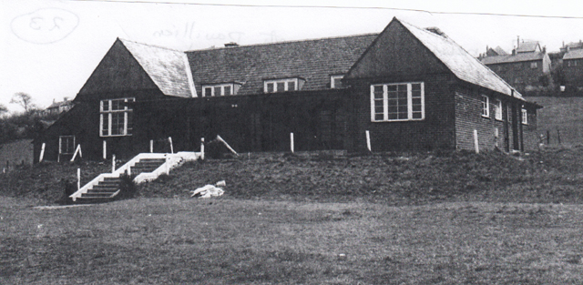
The new Q.E.G.S. sports pavilion opened in 1941 at Lammack
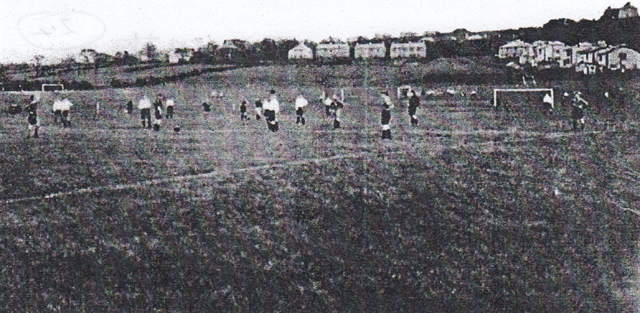 The Harrison Playing Fields in the 1930’s with Q.E.G.S. football teams in action.
In the background can be seen new semi-detached houses built alongside Lammack Road
A picture of the Q.E.G.S. 1st XI Football Team in 1945/6
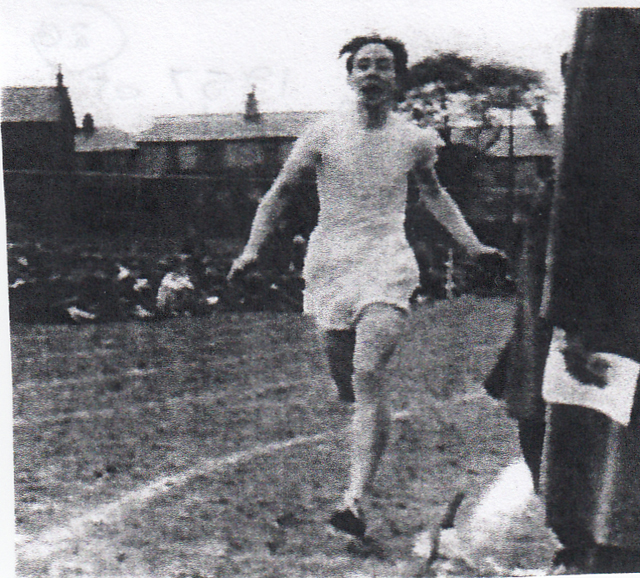 Q.E.G.S. Sports Day in 1957 on the Harrison Fields where ARTHUR SANDFORD
is shown breaking the school record for the 880 yards
A picture of the Q.E.G.S. 1st XI Cricket Team in 1938
Also, partially covering the Lammack area was part of Blackburn Golf Club's course when it was extended to an 18 holes course. Originally formed in 1894 as 9 holes course, close to the first club house based at Revidge. The club was formed following a meeting at the Old Bull Hotel in Church Street, Blackburn and started with original yearly subscriptions of £2/2s with 70 members, and, soon after, admitted lady members who could play between Monday and Thursday. The part of the extended course lying within the Lammack area includes the 10th to the 14th holes and covers the lowest flattest part of the course. Another recreational facility built on the Lammack area border with Ramsgreave was Blackburn Rugby Club created on land behind the properties on Ramsgreave Drive where it was flat enough to create a series of pitches and a pavilion. The club was first founded on the 27th October, 1877, when the club captain was W.R.Haworth and they played their first game on the 3rd November, 1877 against Preston Rovers at Penwortham. Their 2nd game was against Clitheroe at Four Lane Ends behind the Hole-i’th-Wall public house probably where the Blackburn Olympic Football Club played their games. However, after five seasons, the club folded in 1882, then, reformed in January 1921 and played matches on the Yellowhills site at Pleasington with the teams changing in the barn of the Bay Horse Hotel, later to become the Clog and Billycock. The club eventually moved to their present site in 1934. The present, private club was formed in 1950 by three old boys of Sedbergh School in order to play an annual match at Sedbergh against the “Assassins” a team of boys, old boys and masters which continued for a number of years. The original club house was replaced with a new one in November 1964 at a cost of £20,000.
In May 1953, a new primary school opened its doors, called Lammack County Primary School, replacing the old school at Four Lane Ends and built on former farmland in lower Lammack area adjacent to Willow Trees Drive. It opened with 240 pupils and was much needed due to the continual growth of new housing in the area. Its light, airy, single storey building was designed by the Borough engineers and followed Government instructions that new schools had to adhere to, including meals served in the Assembly Hall. It had a well equipped kitchens and corridors which lead left and right to identical wings, each with three classrooms, cloakrooms and toilets. Extensive windows looked out onto external paved teaching terraces flanked with brick flower-boxed walls and main school doors closed automatically. As in other primary school classes at this time there were 40 pupils per class and a teacher. One of the outside play areas was fitted with modern gymnasium equipment rigged with ropes and nets. An additional external grass area was also available for outdoor sports, especially football. This new school was way ahead of the old one at Four Lane Ends where even with three additional wooden huts was too small and older boys had to be moved as a class in a building a mile away.
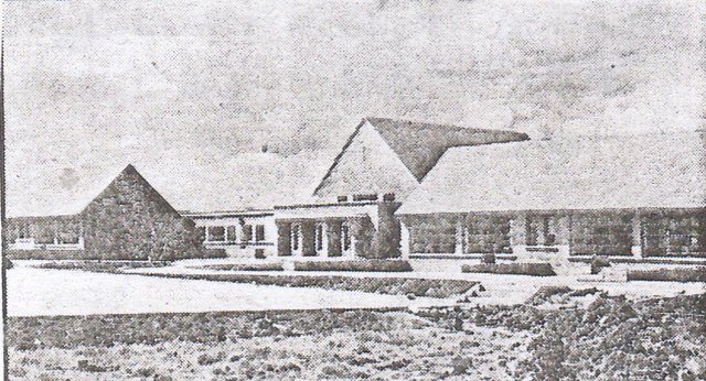
The new Lammack Primary School frontage also showing the terrace and play area
Another view of the outdoor play areas with the latest gym equipment rigged with ropes.
By 1953, there were plans to use the old Four Lane Ends School as one for children with special needs to save some local schools from having to organise special classes. It was proposed to start with 60 children, aged between 7 years and 8 years old, and then work up to 100, initially, all coming from the Blackburn area.
The old former Four Lane Ends School now used for Special Needs children from local Primary Schools
AN ORDNANCE SURVEY MAP OF THE PLECKGATE AREA IN 1956
As in the Lammack area there were major developments in Pleckgate between 1894 to 1956, especially with the large increase in housing and leisure facilities caused by the same reasons as in Lammack. Again, most of the new housing developments followed a linear pattern particularly the in-filling of land alongside the new orbital by-pass road, namely the Ramsgreave Road section, and also, Pleckgate Road which by now was officially named Pleckgate Road. The new housing was mostly developed in the 1920’s and 30’s during the inter war years but with more recent developments, post Second World War, forming the first estates. The new housing stock was largely made up of semi-detached houses and bungalows both detached and semi-detached with a few additional detached houses.
Ramsgreave Drive looking towards Brownhill with new detached bungalows
to the left and new semi-detached houses to the right
A closer view of the new detached bungalows sited on Ramsgreave Drive.
The largest increase in housing can be seen on the lower flatter area of Pleckgate Road towards its junction with Ramsgreave Drive, including the new Wilworth Crescent, and other new housing could be found on either side of the upper section of Pleckgate Road on sloping land. In post Second World War times, a new council estate had been developed off Whalley New Road, round Rosewood Avenue, as post war demolition of many old terraced houses in inner Blackburn created a huge re-housing programme on green field sites on the outskirts of Blackburn including these and those on the Brownhill and Shadsworth estates.
On the transport side, as in Lammack, the roads, especially Pleckgate Road, had been upgraded and were recognised in local telephone and trade directories as road transport was now the dominant force for public and industrial use. Industry in the Pleckgate area had grown considerably both with Roe Lee textile mill and a Laundry business at Ramsgreave. Roe Lee Mill now had an additional New Mill which was constructed in the 1905/6 period by Duckworth and Eddleston when textiles were expanding with the help from William Birtwistle and had 828 weaving looms eventually. The mill was run in conjunction with the older mill and in 1930, John Duckworth and Sons operated the two sites creating mostly damasks, brocades and quality jacquard weaving until Viyella International took over control in 1964. Another industrial development was Ramsgreave Steam Laundry built in 1904 by ELi Haydock and his sons Edwin and James. James Haydock was formerly involved in textile manufacturing of heald and reeds but later helped set up the Laundry. It later became Haydock Brothers Ltd. and, in 1954, also started to dye tufted carpets and bedspreads which eventually became a separate company called Haydock Dryers Ltd. Much of the laundry's original equipment was manufactured by Cherry Tree Machine Company and operated by steam power including hydro-extractors drying ranges and commercial irons. The laundry was a single storey building with a two storey block added later, all brick built, with large, round headed windows with a brick built range of single storey dye houses behind.
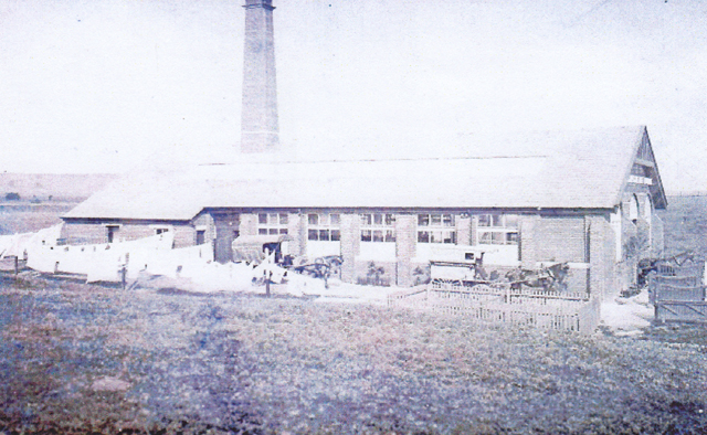
Steam Laundry on lower Pleckgate Road
The original Steam Laundry, in the early 1900s, was set up on lower Pleckgate Road, Ramsgreave. Horse transport was the order of the day for carrying laundry. The laundry above can be seen on lines drying outside the works with the mill chimney behind.
This 1924 sketch shows the detail of the Haydock Brothers Laundry frontage at the Ramsgreave site
The above 1927 sketch of the Haydock Brothers Ramsgreave laundry and its full complement of buildings was advertising the company as dyers, dry cleaners and laundrymen equipped with model plant that could also create pleats in material.
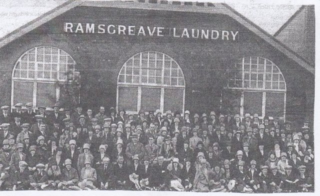
A 1928 photograph of Ramsgreave Laundry workforce
The photograph shows, James Haydock, the founder of the laundry, in the middle of the second row from the front wearing a hat sat next to his step son, also called James Haydock, who isn't wearing a hat.
At this time, Royshaw Brick Works, was still in operation by the quarries, and, by now, considerable areas of the quarries were unused and one small quarry a delf was renamed Tom Crooks Delf, after its owners name, which, by now, had been infilled with water to create a large pond. The delf became a health hazard with children playing near it and the odd accident and a suicide.
Following the trend displayed in the Lammack area for more leisure space to pursue leisure activities, mostly traditional sports, a former large field at Higher Wilworth was taken over by the council and named after Mr. Woodridge, a long standing council worker to create the Woodridge Playing Fields, used by local league clubs for football and cricket, then by local Primary Schools when more fully developed in the 1960s The fields were used at one time by Blackburn College students for outdoor sports, and, when re-developed, had full size football pitches and mini-pitches for juniors. Another recreation ground was created alongside Roe Lee Mill to provide facilities for its workers. Land off lower Pleckgate Road between it and Ramsgreave Drive had also been developed by both St. James Church and the council. One section, purchased by the Church, who donated it for a sports ground was developed into a cricket ground for the Church's cricket team; this ground was later taken over by a private club namely Blackburn Northern Cricket Club. Another section was developed by Blackburn Borough to provide another football pitch adjacent to Ramsgreave Avenue which was also used by Junior School pupils. On land across from this pitch, fronting Pleckgate Road, where later, Pleckgate School was built, trials were held in 1964 by the Civil Defence for an emergency feeding exercise complete with temporary brick built ovens in case of a future crisis.
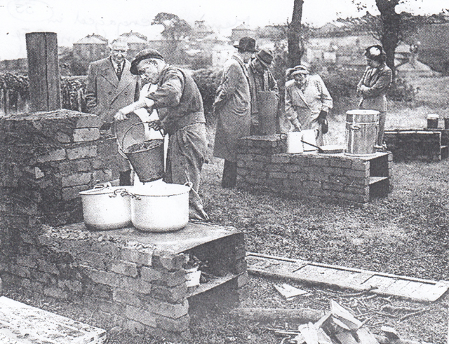
Civil defence members engage in an emergency feeding exercise in 1954.
During the period from 1894 a new Methodist chapel had been erected at Four Lane Ends to serve the growing population in the area. Previously, in 1881, Four Lane Ends Independent Sunday School was built opposite the site of the new church and would have also been used as an early church (see the site on the map). At a later date, this building was taken over by Turners Blinds, and, more recently, a car sales company.
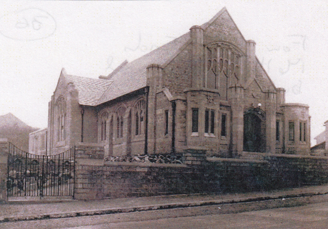
A view of Four Lane Ends Methodist Chapel built in 1900 with stone facing and an ornate frontage.
By 1956, St. Chads still served the Pleckgate area as a Junior School, but, by now, the new Lammack and Roe Lee Schools were available to also serve the area's needs.
Due to the many new housing, transport and recreational developments in the area the amount of farmland had greatly reduced; farms were demolished or turned into purely residential properties. As a result, there was far less productive land and some open areas were now left unused. Royshaw farm was just one of those demolished, sited overlooking Tom Crooks Delf and close to where the original lane linked Pleckgate Road with St. James Road. It was demolished in the1930's and its rubble was removed from the site and taken to the site of Salmesbury Aerodrome which was being constructed. Another building that was demolished was Brook Farm sited behind Ramsgreave Laundry when the Shorrock family who owned it gave permission for the building of four semi-detached houses to be built on their land going towards Brownhill Cottage.
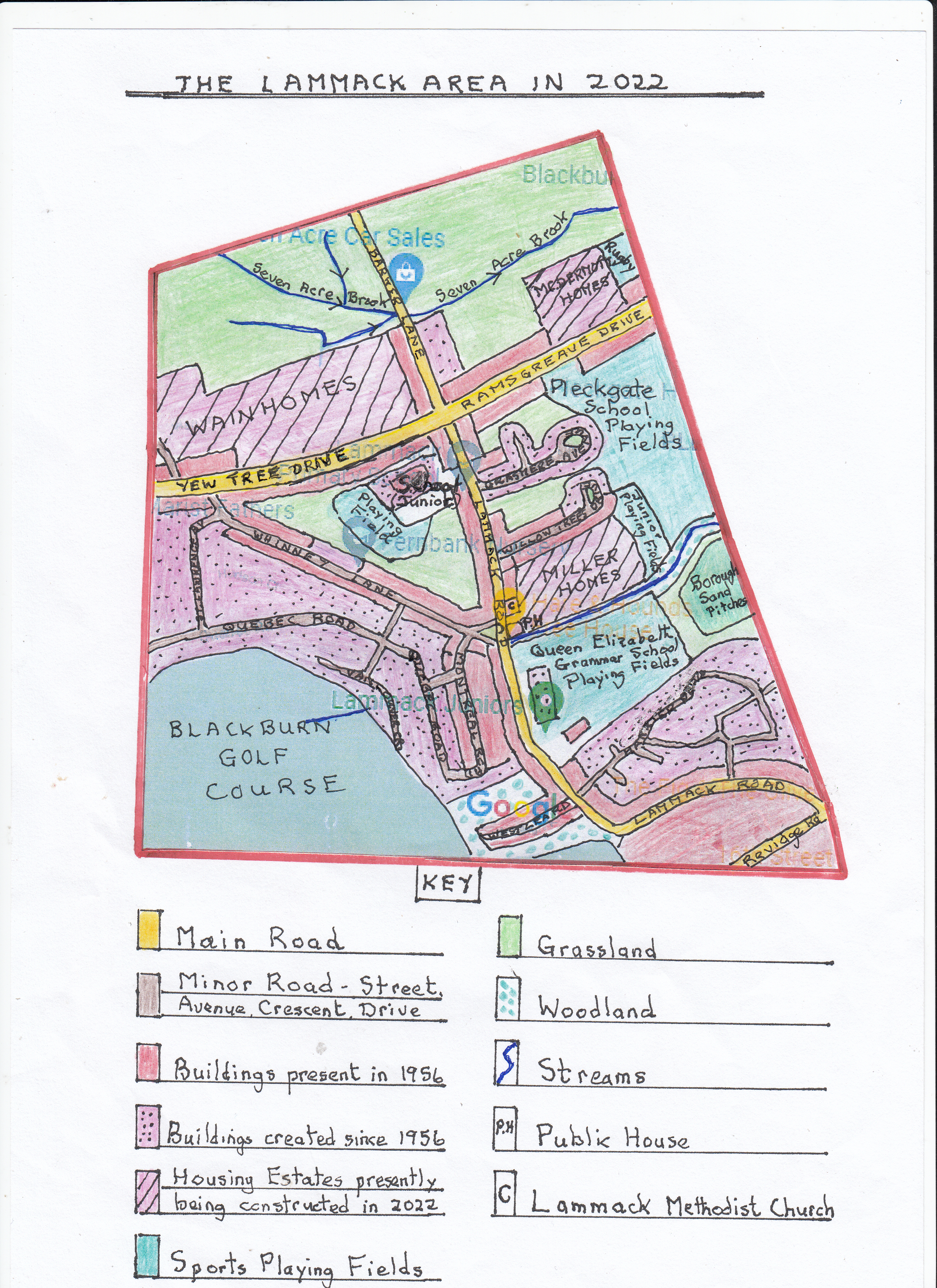
AN ORDNANCE SURVEY MAP OF THE LAMMACK AREA IN 2022
Over the last sixty-six years the Lammack area has gone through its largest ever transformation, and, apart from the upper parts of Ramsgreave, has become a built up suburb of Blackburn almost completely consisting of private homes with open spaces almost solely devoted to leisure pursuits. The building spree is currently being massively increased with three new housing estates under construction with the largest being Wainhome's “ The Hedgerows" off Yew Tree Drive, stretching from Barker Lane to Whinney Lane in lower Ramsgreave, consisting mostly of detached modern houses. A smaller more select development by McDERMOTT HOMES called “Highgate" off Ramsgreave Drive consists of exclusive detached houses again on lower Ramsgreave and overlooking Blackburn Rugby Club pitches. The final medium sized estate is by MILLER HOMES built on the former Old Blacks Football Ground behind the Hare and Hounds Public House and Lammack Methodist Church.
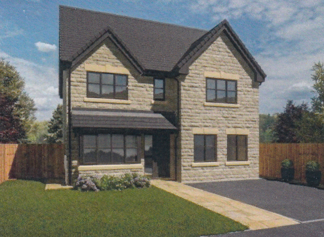
Modern exclusive detached property on the “Highgate" estate

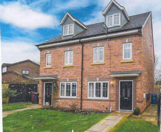
A typical detached and semi-detached property located on the Miller Home development
Prior to these latest developments, the large Lammack Estate of mixed housing was created in the late 1950s and early 1960s, off the existing Montreal Road stretching from Whinney Lane to Yew Tree Drive and bordering the lower end of Blackburn Golf Club. It consisted of 200 brick built homes covering land previously part of the Higher Barnes farmland with mostly semi-detached houses and detached bungalows with the odd detached house as part of the biggest private house building project in Blackburn since 1939, all with gardens front and back and garages.
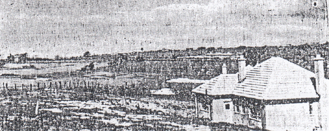
Higher Barn farmland being developed into the Lammack estate in the late 1950's
A new feature was that all the new houses/bungalows came with fully fitted kitchens which were light and airy with the only difference between homes being the sizes of lounge and dining rooms. Additionally, all the homes came with gardens front and rear with a space for a garage and driveway. Once completed with its connecting roads it has since been added to and now connects to the Beardwood estate running from Preston New road which consists of much more varied, mostly detached properties.

This image shows an advert for the Lammack Estate at the time of construction
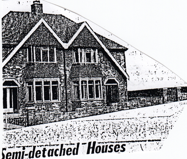
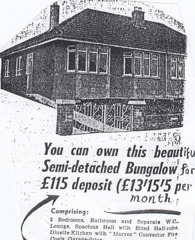
two adverts for the estate's new semi-detached Houses
Another housing development in the Lammack area during the 1970s/80s was the 115 home Hawkshaw Bank Housing Estate off the top end of Lammack Road which included mixed housing types, built of brick, with a few apartments all with gardens and garages overlooking Queen Elizabeth's Grammar School playing fields.
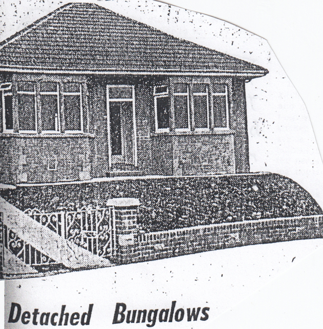
A picture of a detached property on Falcon Close in the Hawkshaw Bank estate
In earlier times, during the late 1950s/60s, other housing developments in the area included the completion of Willow Trees Drive with added bungalows and the completion of Grasmere Avenue, on a similar design, off Lammack Road opposite Lammack School, mostly consisting of bungalows on land previously part of Cunningham House. Again, in the 1980s, more new detached houses were built opposite Seven Acre original stone cottages on Barker lane to complete the areas built-up pattern.
Other than new housing developments, Lammack School has had to be enlarged with a new wing added to encompass infants with further added classrooms due to the increased population in the area.
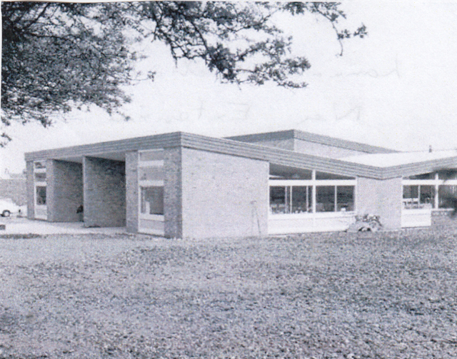
The new extension to Lammack Primary School
Recently, it has been announced that the school will be having 10 mobile classrooms added to the site to cater for the increased demand from the new housing estates being built in both the Lammack and Pleckgate areas. Another new development since 1956 has been the building of Lammack Methodist Church on Lammack Road close to the Hare and Hounds public house. This originated in the 1950s when the Clayton Street Methodist Circuit looked into developing the Methodist cause in the Lammack area. A Sunday school was first opened in 1952, and, soon after, a service for adults on Sunday evenings using the Old Blacks Football Club pavilion, then Lammack School's main hall to meet the growing need in the area. Following this, appeals in the late 1950s for funding raised £2000 towards the £12000 projected cost of a new church. The church was first opened in 1960 and steadily grew as a neighbourhood church, involving youth activities and recreational courses but, it soon became clear, the premises were inadequate and plans were drawn up to enlarge and enhance the existing facilities. Local enquires revealed widespread wishes for youth activities including both cubs and scout groups. Eventually, the funds were raised to complete the transformation with the opening of a new £155,000 extension.
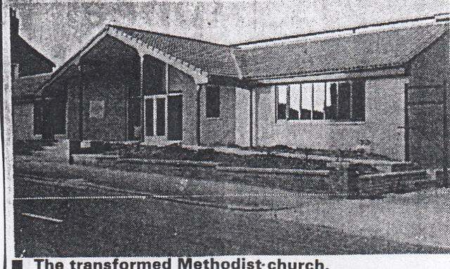
The new Lammack Methodist Church extension on Lammack Road
Another new church building development had occurred at Four Lane Ends as the existing chapel had undergone a huge transformation with a large new extension dating from the 1980s, including a purpose built hall, kitchen and function room and now went under the name of Revidge Fold United Reform Church.
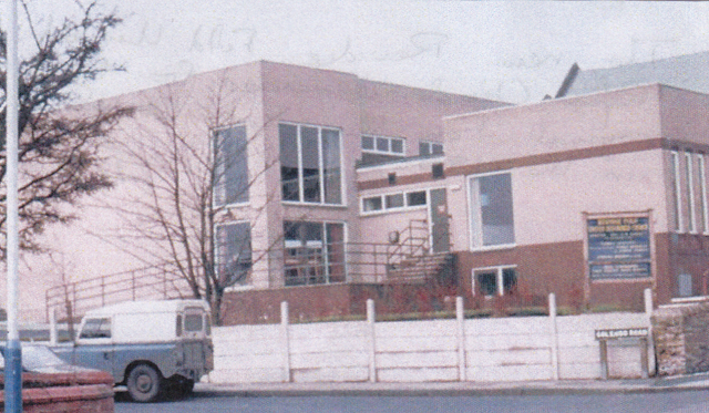
The new extensions to Revidge Fold United Reform Church completed in the 1980's
On the leisure side, Blackburn Rugby Club had replaced their old clubhouse with a new one which opened in 1964 and looked out onto the pitches with extensive windows.
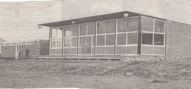
A front view of the new Blackburn Rugby Club clubhouse
Queen Elizabeth's Grammar School sports pitches have had to be upgraded on a number of occasions since 1956 to help improve the drainage due to the clay sub-structure. More recently, in September 1989, a large new Sports Hall was built close to Lammack Road after a seven year planning wrangle with local neighbours on Lammack Road at a cost of £400,000, funded from an appeal and the Old Blackburnian's Association. This provided much needed indoor sports facilities for when the weather was inclement. The Old Black's Football Club continued, until recently, fielding up to four teams in the Lancashire Amateur League and on part of the land owned by Blackburn Borough between their pitches and those of Pleckgate School, Lammack Juniors Football Club was established by leasing the land and creating junior pitches. However, in recent times, the Old Blackburnian's Association who own the Old Black's land decided to sell it to raise capital for the school's needs to a housing developer, therefore, the old Blacks teams now play on the Grammar School's pitches and use their changing facilities whilst using the Hare and Hounds Public House as a clubhouse.
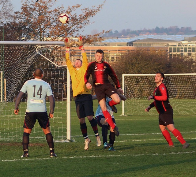
One of the Old Blacks football teams playing a game on the original first team pitch
before it was sold for housing with Pleckgate School in the background
Blackburn Borough developed farmland behind Grasmere Avenue and Willow Trees Drive when Pleckgate School was built in 1968 and created playing fields for football, hockey and cricket and also built sand football pitches across the stream for local league football use and for Pleckgate School when its pitches were waterlogged.
The former Four Lane Ends Primary School building has seen a number of changes having been used for a Further Education School for Domestic Science with both day and evening classes for women and girls over 15 years. Later, it was used for a variety of Evening Classes for the local population, run by the Local Authority, and was used as an overspill site for Pleckgate school classes and girls over 15 years for a time before it was eventually demolished. The site is now a small gated private housing development.
The only remaining farmland left in the Lammack is in the Ramsgreave area behind the new housing developments and existing rugby sports facilities.

AN ORDNANCE SURVEY MAP OF THE PLECKGATE AREA IN 2022
As in the Lammack area, Pleckgate has also seen huge developments over the last sixty-six years, with massive increases in its housing stock especially of the upper parts of Pleckgate Road. However, most of the new housing developments have occurred in the period 1980s – 2000s with only one current housing estate being developed by Persimmon Housing called “The Blossoms”. This development is on land to the rear of The Knowles Public House and Ramsgreave Drive from which there is access and along the side of the railway. It will consist, when finished, of a mixed development of modern town houses, semi-detached and detached houses.


An example of new detached and semi-detached properties on The Blossoms Estate
Other major developments of housing estates include the Rhodes Avenue development created in the 1980s that spread out to meet the Lammack Hawkshead Estate consisting mostly of semi-detached housing. An additional, smaller development by Faircloughs Houses below Rhodes Avenue, again off Pleckgate Road, was the Swallowfields Estate whose show house was a large thatched roof detached house valued in 1970 at £200,000 offering a wide range of facilities and a large garden.
A view of semi-detached property on Rhodes Avenue
A picture showing the Swallowfields Estate show house
Further down Pleckgate Road there was a small housing development created round Barnmouth Close consisting mostly of bungalows. On the other side of Pleckgate Road, the Pleck Farm Avenue and Rosewood Avenue Estates developed and merged creating a huge development of mixed housing including detached, semi-detached, bungalows and town houses created in the period
1970-1990.
The Pleck Farm Estate showing town houses on Cranshaw Drive
Another view in Pleck Farm Estate of detached bungalows on Pleck Farm Avenue
At the upper end of Openshaw Drive another housing estate phase although smaller was developed round Royshaw Avenue. Other housing developments occurred out from St James's Road merged into these estates together with another development between the Woodridge Playing Fields off Royal Oak Avenue and the nearest estate. The area has presently two undeveloped areas which await development including the open site where the original Roe Lee Mill was sited before it was demolished and the St. Chads Church site where the church is in the process of being demolished. The site of the church was acquired by Adam Country Homes Ltd with a scheme to build seven new homes on the site in 2018 but is still awaiting development. For a number of years, the church was used by Pleckgate School as an extra teaching area and then for a business supplying fancy goods to local shops.
Since 1956, Ramsgreave Drive has been significantly upgraded as a dual carriageway, linking Whitebirk and the M65 to
Preston New Road. As in Lammack, due to the huge building programme since the 1950s, the only farmland left in the area was beyond Ramsgreave Drive.
Another major development in the Pleckgate area was the building of five new schools following the 1966 Borough Education Plan. Firstly, this established the need for new Comprehensive Schools after the abolition of the old 11+ examination and selected secondary modern, technical and grammar schools. One of the new comprehensive schools to be built outside central Blackburn on more green-field sites was Pleckgate School which replaced Blakey Moor Girls High School and Bangor Street Boys School. The School was situated on land previously used for playing fields. The new co-educational school was opened by Alderman Renshaw in 1968 with all the latest facilities for pupils of all abilities and included a sports hall, a large assembly/dining hall, a dedicated 4th/5th year centre for older pupils, accommodation for adult students for evening classes and excellent playing fields and playgrounds for 660 pupils. Plans were also in place to extend the school to 900 pupils with the addition of three new rear teaching blocks, one of which, also included a counselling centre for individual heads of year and offices for the Headmaster and administration staff. Eventually, the school would have accommodation for 1200 pupils on site, and, at one time, operated a 6th form centre before local schools lost them to the local 6th form Colleges. Pleckgate School also had its own dedicated bus lay-bye at the front of the school, off Pleckgate Road, as many pupils travelled in from different primary school areas.
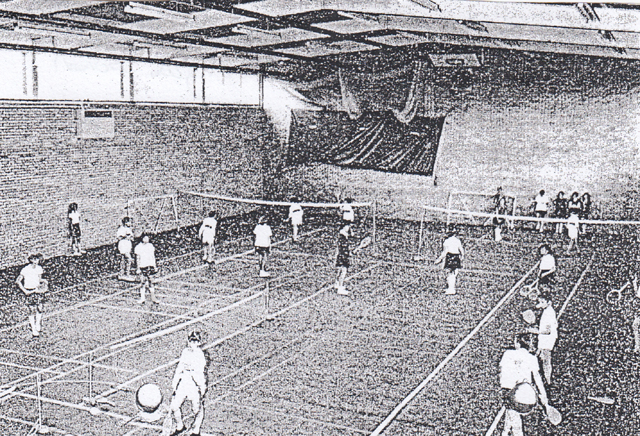
A picture showing the new “All Purpose” Sports Hall built at Pleckgate School
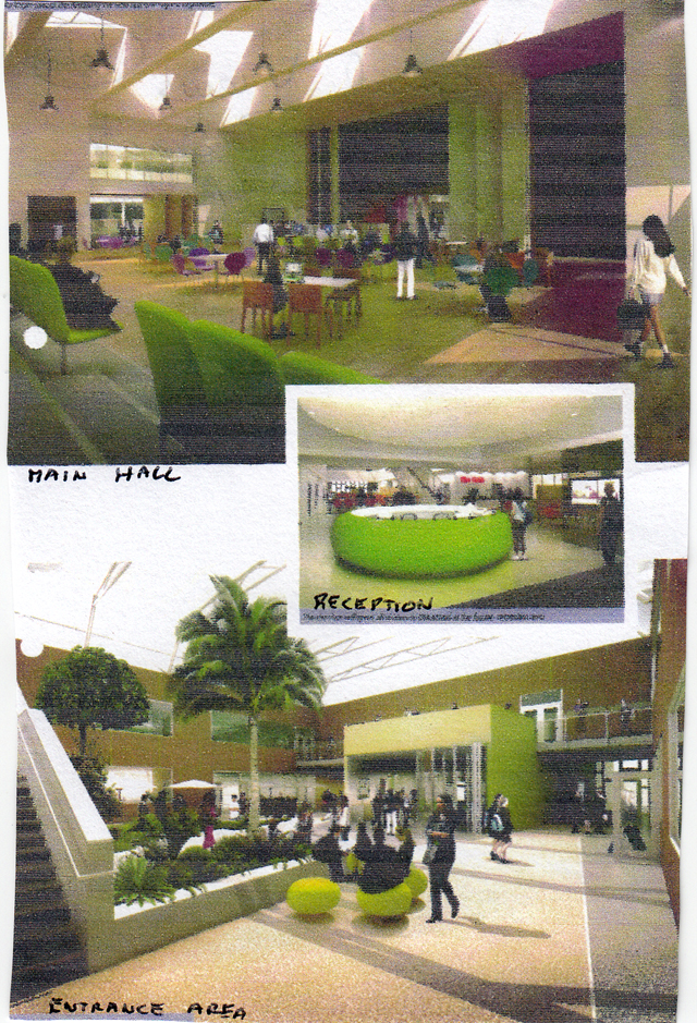 A view of the dedicated centre at Pleckgate School for the older 4th and 5th year pupils
In the early 2000s, a new Technology Centre was built at the front of the school off the bus lay-bye. This was to provide I.T. skills for locals, Pleckgate pupils and local businesses. It was one of two built in the borough at the time; the other one was at Witton Park school. Today, the centre is called the Education Partnership Trust. A replacement school was planned from 2009 to be built behind the existing school which would be demolished as part of the “New Schools for the Future Scheme” which was handed over to the Headmaster
Mr. Campbell in August 2012. This, in turn, became a Mathematics and Computing College/Academy when special school skills became fashionable. The new school included state of the art accommodation and facilities with a new all-weather pitches to the rear together with new play areas and playing fields. These facilities were also used extensively out of school hours by many locals especially for I.T. and sports by evening classes or hired by various organisations.
The frontage of the new Pleckgate School opened in 2012
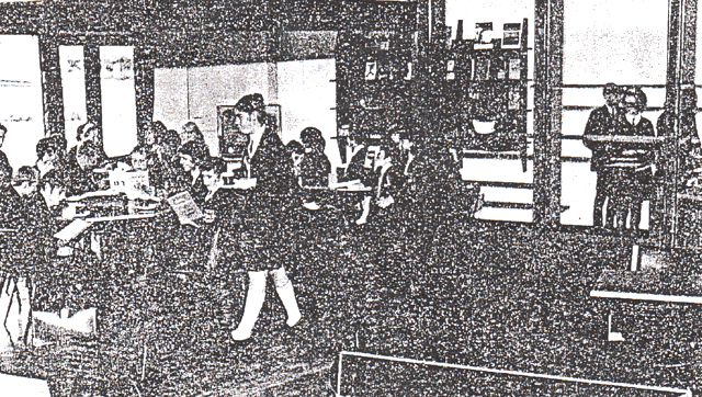
Internal views of the new Pleckgate School/Academy
The use made of the Schools Sports Hall by out of hours users
The opening of St. Gabriel’s Primary School
Two further church schools were opened in the area both off Wilworth crescent on former open grassland. The first was St. Gabriel’s Primary School which had previously operated from a site on Cornelian Street, off Whalley New Road, in the Roe Lee area, and also, in the church hall. Members of the church helped raise money to open the school for junior pupils in 1970 with two classes and further phases planned, with the remaining younger Infant and Junior pupils remaining at Cornelian Street. The final phase to incorporate all the schools pupils was opened in late 1980 by the Bishop of Blackburn and the school could now accommodate 253 pupils.
The opening of St. Gabriel’s Primary School by the Bishop of Blackburn
This faded view shows the Bishop of Blackburn, watched by Cannon Williams, and the school Headmaster, Harry Sharples, opening the last phase of the new St. Gabriel’s School in 1980. Since the opening, the school has had to further expand due to rising numbers of pupils in the area.
The second church primary school to be opened was Holy Souls Roman Catholic School which was opened in May 1976 by the Bishop of Salford and took its first pupils in 1974 with the Head being Miss Mary Smith.
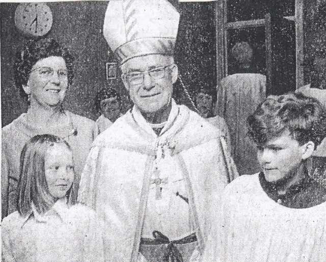
Holy Souls Primary School is opened in May 1976 by the Bishop of Salford with Miss Smith and pupils
By 1980, 165 pupils were crowded into the school, built for 120, six years after it was left half finished by Lancashire County Council. Blackburn Education Committee however felt it couldn’t spend money building extensions to the school when St. Albans R.C. School on Whalley New Road near the town centre had unfilled places. However, later in the 1980s/90s, the school was extended to its present form to accommodate more pupils.
Another two primary schools were also built off St James's Road in the 1980s; these were the Junior and Infant schools at the Cedars and Hawthorn sites to replace the old Cedar Street school on St James's Road. All the new schools were necessary to provide education for the large number of families children who had moved into the new housing estates of both Lammack and Pleckgate.
Over the years, the area has seen changes on the industrial front, first with the demolition of the original Roe Lee Textile Mill; the site is currently earmarked for a seven-day-a-week car sales site on the 7,445 square metre plot as a new commercial venture with two portable buildings on the land for the sales staff. Additionally, there has been a change in direction of the use of Roe Lee New Mill, which, after closure, became a Roe Lee Business Park containing 12 independent industrial units operated by a range of different firms who rent the units. A similar change has occurred at Haydock Laundry at its Pleckgate Road site as general laundry business declined in the 1970s and closed in the 1980s; Haydock Dyers also closed in 1982. Today, the former laundry buildings have been sub-divided into units which are rented out to different firms with a small section involved in dry-cleaning work. Another business that developed at the lower end of Pleckgate road was C & H Motors Garage which has been involved in motor vehicle repairs and MOT testing.

An advert for C & H Motors Garage on lower Pleckgate Road
Another business unit was built off Openshaw Drive along with some shops to cater for local needs. Two new public houses also opened in the area as the Knowles Arms moved to a new site fronting Ramsgreave Drive behind the much smaller original inn on Pleckgate Road. It was opened in 1958 by Lion Brewery and built in a traditional style made of hand-made rustic facing bricks with natural and re-constructed stone relief and offered extensive car parking just off the main road and provided up to date facilities.
A sketch of the new Knowles Arms public house opened by Lion Brewery in 1958
Over time, the public house incorporated areas for meals and became a popular destination changing to an EGO Restaurant in more recent times. The second new public house, The Farthings, was built on Rosewood Avenue; it was a free house offering fine ales together with lunches and bar snacks with facilities for private parties. It opened in 1978 and provided extensive car parking along with advertised evening entertainment.
The new “The Farthings” Public House opened on Rosewood Avenue in 1978
On the leisure side, increased sports facilities were made available in the area with the new schools and the local authority creating sand pitches alongside those of Pleckgate School. Blackburn Northern Cricket Club extended its facilities to include squash and a large bubble was erected at the top end of the Borough football pitch, close to the club, for indoor tennis coaching in the winter months as the club already had outdoor tennis courts. In recent times, the club has ceased its cricket activities with the cricket field now used as an additional sports area by Pleckgate school. Additionally, Blackburn Hockey Club also use the club as a centre after using Pleckgate Schools “All Weather “ pitches before transferring to Witton Park. The Woodridge and St Mary’s Playing Fields have undergone numerous up-grades due to drainage and levelling issues although the siting of a new large sewer tank under the section of playing field near to Royal Oak Avenue created difficulties. The Woodridge Playing Field are fully used by schools and local league football teams at weekends. In 2018, the Borough Sports Pavilion sited close to Blackburn Northern was completely re-furnished as it had become very run down, using a grant of £100,000 from the Premier League and F.A. Football Facilities Fund helping to create an additional kitchen, office and maintenance store and refurbished changing rooms to serve the teams using the six pitches available nearby. Many local leagues now use the pitches including Blackburn Sunday League, Blackburn Combination and Blackburn Rovers ladies teams.
Today, both Lammack and Pleckgate areas have become very popular and vibrant areas offering a wide variety of modern houses, a wide range of leisure facilities and modern schools. As a result, the area is very popular for families especially with young children and has become a real asset to the Borough of Blackburn.
Sources
The author's own resources
Abram, W. A., 'A History of Blackburn Town & Parish'
Beattie, Derek, 'Blackburn: A History', Carnegie, 2007
Miller, G.C., 'Blackburn: Evolution of a Cotton Town'
Notes (and newscuttings) on Roe Lee, Lammack and Pleckgate, Blackburn Library, shelved at E02
Rothwell, Mike, 'A Guide to the Industrial Archaeology of Blackburn, Part One: the Textile Industry', Hyndburn Local History Society, 1985
Rothwell, Mike, 'A Guide to the Industrial Archaeology of Blackburn, Part Two: Other Industries', Hyndburn Local History Society, 1986
Timmins, Geoff, 'Handloom Weaver's Cottages in Central Lancashire', University of Lancaster, 1977
The Victoria History of the County of Lancaster, Volume 6

